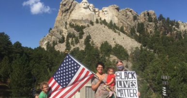

- Mount Rushmore
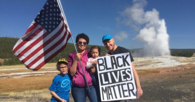
- Yellowstone
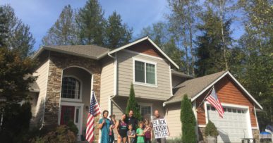
- Home Away From Home
- Space Needle
- Mount Saint Helens
- Rocky Mountain National Park
- Chimney Rock
- Home
Johnston Ridge Observatory
We started heading south early in the morning, knowing we had at least a 3 hour drive ahead of us. Fog was everywhere, and I worried about what it might look like when we arrived at the volcano. I shouldn’t have, though. Within an hour of starting, there was nothing but pure dark blue skies and sunshine to be seen. It even started growing hot. We had to take off the extra layers we started out with because of the rapidly increasing temperature.
Taking I-5, we headed south and nabbed some lunch before starting our journey to the mountainside via Highway 505. Turning left off the 505 onto Spirit Lake Highway greeted us with a sign that said that Johnston Ridge Observatory was closed. It was not subtle. I’d feared that’d be the case as Rita had mentioned it while we researched our options back in Monroe.
But we persisted. We were at least hoping to turn off and snap a picture as close as we could get. The whole drive was fraught with worries that we’d be turned away, even as we were amazed by the mountain landscape building around us. What would we find when we arrived?
The elevation and the switchbacks were causing Katrina to become nauseous, and we had no idea whether we’d be able to find a good parking place to catch our breath… let alone set up for a picture. All bets were off with the multiple closure warnings due to COVID, no doubt. But we kept driving, and we didn’t encounter any closed roads. My phone soon had zero connection. That was happening rampantly after I dropped it on the concrete back in Leavenworth. It ended up being a blessing in disguise, though. I’m not sure how long it’s been since I’ve truly detached from my phone.
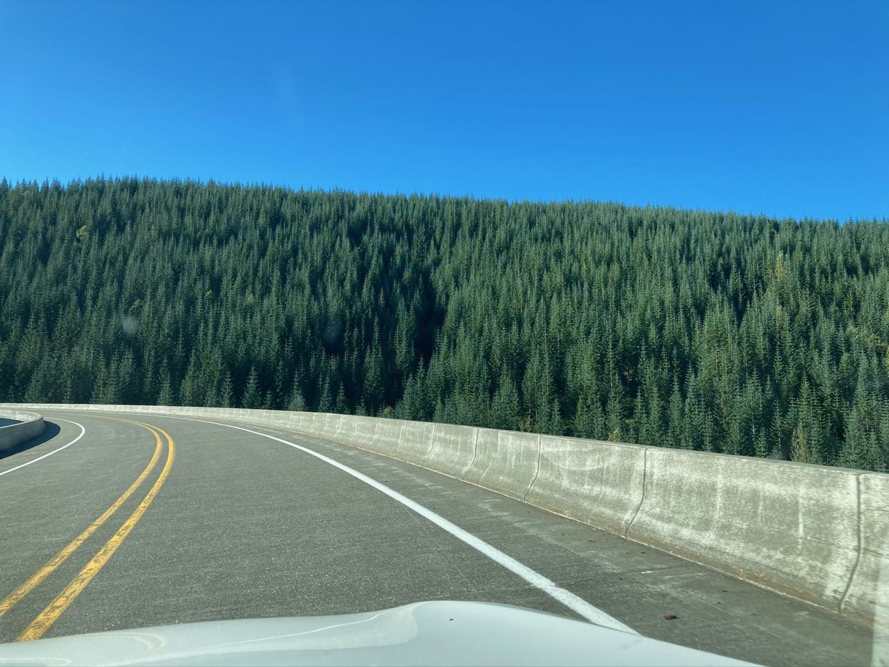
But last my phone told me anything, it’s that navigation was red along some portion of the only road that we could take to the Johnston Ridge Observatory. The 504, or Spirit Lake Highway, was the only road in and out. As passed over the multiple beautiful roads, it became clear that we were in logging country. Massive utility trucks and semis bearing fresh-rough-cut trunks passed us every so often. We got stuck behind an oversized truck that eventually pulled off to let us pass. We were grateful, but also nervous to be going alone to what we assumed was either road closures or worker-only areas.
Eventually we discovered why my phone showed red navigation data. A logging operation had been loading massive trucks with stripped trunks. Wood chips and needles and leaves and small branches littered the road and the surrounding ground. The citrusy smell of fresh-cut cedar or pine hung heavily in the air.
Lucky for us, they’d just wrapped up!
We kept on, and we kept getting higher and higher. Eventually we saw it! There was a beautiful moment where we came out around a switchback loop and there was the crater of Mount Saint Helens, and the snow-capped peak of Mount Rainier just opposite and set against a dark blue sky. There was a turnout, thin, and parallel to the road, there. I wanted so badly to stop just to snap a quick panorama. But Katrina was not having a good time, and we had no clue what was in store for us up the road. So we pressed on.
We came to a gate that could be closed, but thankfully wasn’t. And we started seeing more vehicles that were clearly not work-related. We started breathing easier as we realized that something, anything, had to be available up ahead.
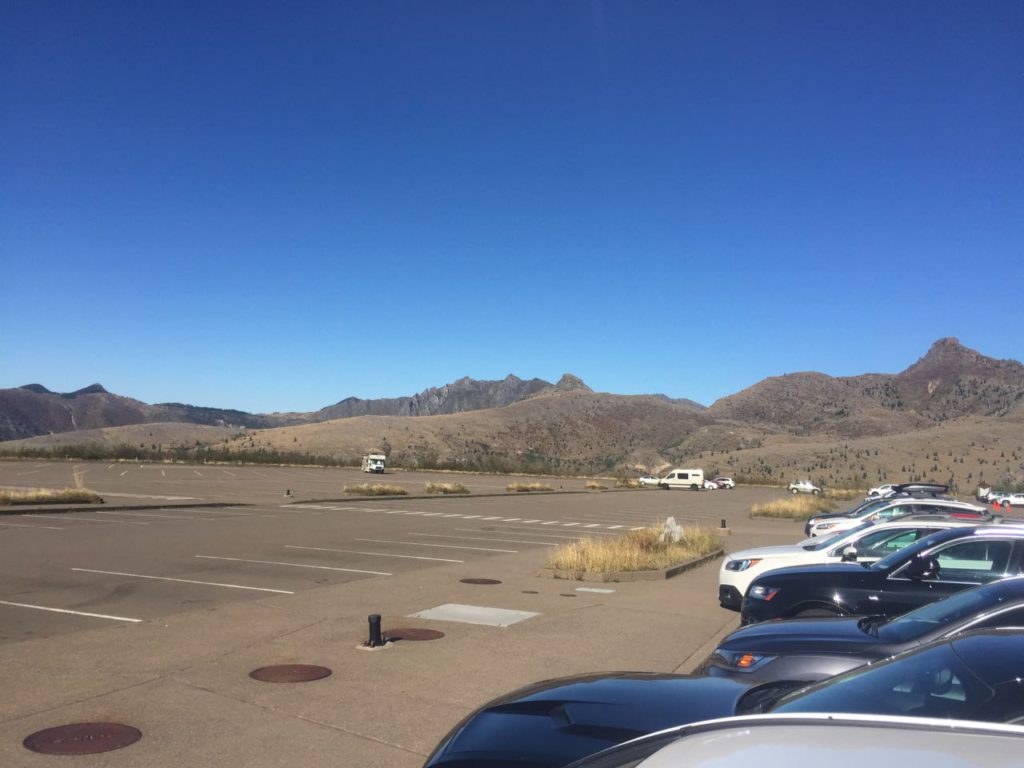
We passed another turnout, and still no closures. So we drove all the way to the Johnston Ridge Observatory parking lot and trail head. Easy peasy. We had the place almost to ourselves. It was glorious, and hot! We masked up to respect the few visitors that were there with us and grabbed the stroller. I felt none of the pressure of the past shots, but still worried about where the sun appeared. I knew the direction of the mountain meant that we were going to be back lit.
There was nothing for it but to move ahead. Our moment had arrived, for better or for worse.
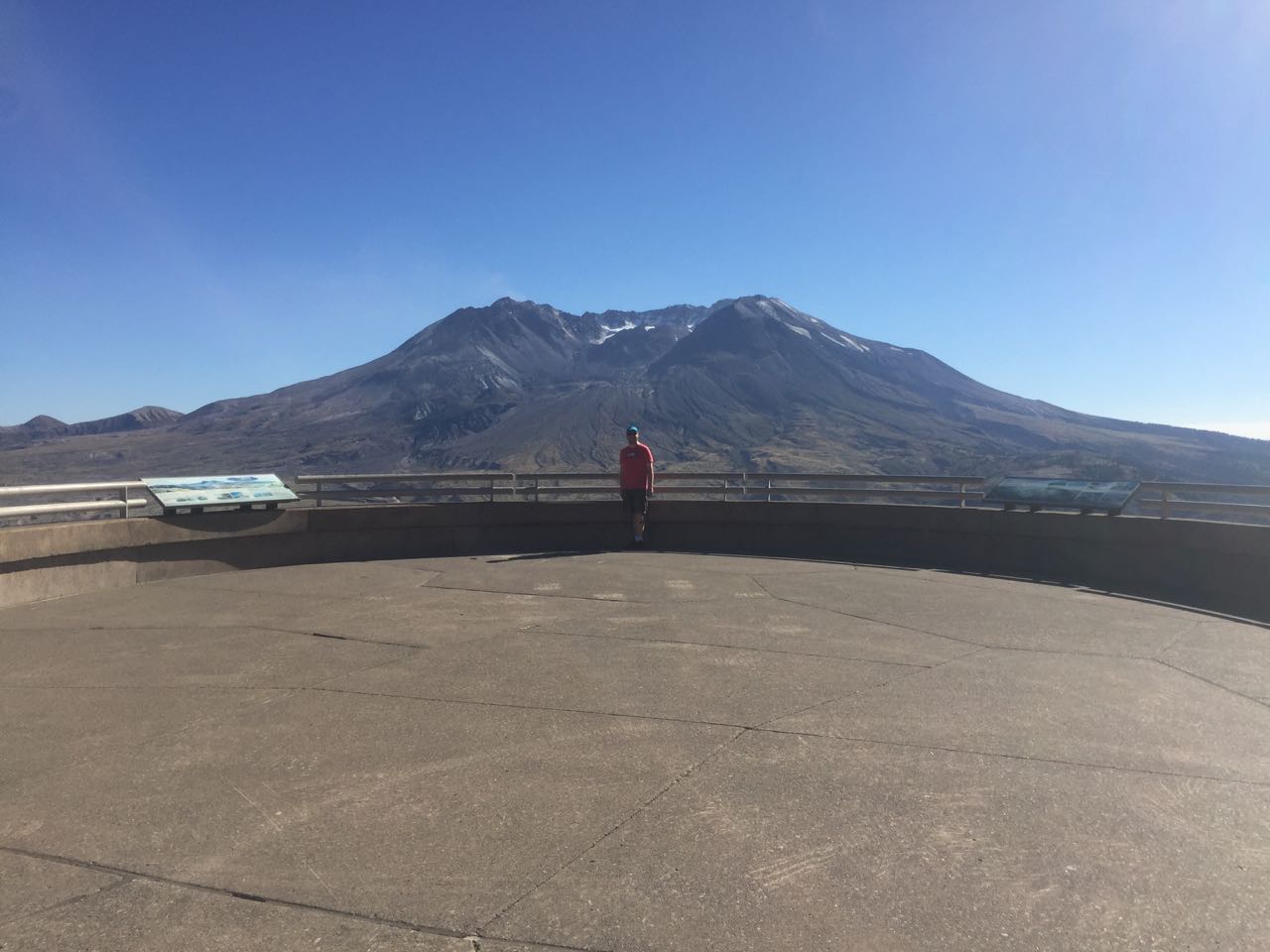
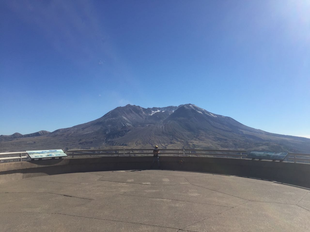
It was only about the distance of a neighborhood block to the observatory itself. We marched onto the lookout, with scarcely anyone else in sight. We turned around at the sound of the observatory doors swinging open, and we noticed that the gift shop was actually open! There were also portable toilets off the parking lot. We had everything we needed, and we also had bugs.
There were yellow jackets or some other type of wasp/bee-like insects everywhere. They didn’t cause us any harm, but they were unmistakable. I knew if we kept moving, that Katrina may feel a little better about it. So I made straight away for the trail leading above the observatory to try and get a better angle for our shot of the mountain.
We had everything we needed, and we also had bugs.
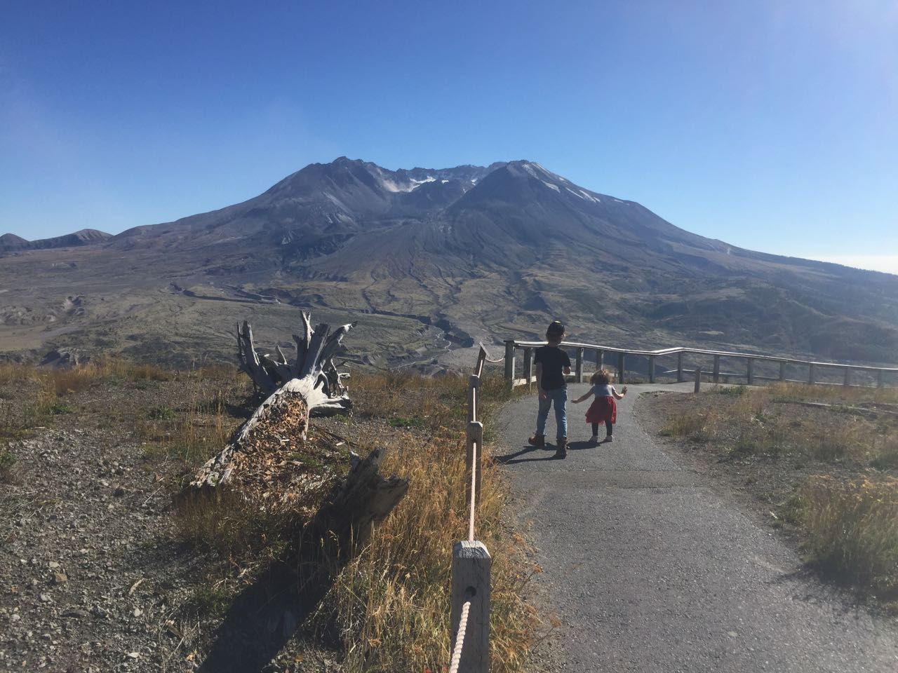
We marched onward up some walking trail switchbacks. Katrina had let Tori out of her stroller so she could get some time walking, instead of sitting constantly. The quality of the trail was amazing. It was also well-preserved. There were still splintered trunks from the explosion and eruption that occurred there 40 years earlier. The decaying wood lay in the direction they had been felled by the force of the blast.
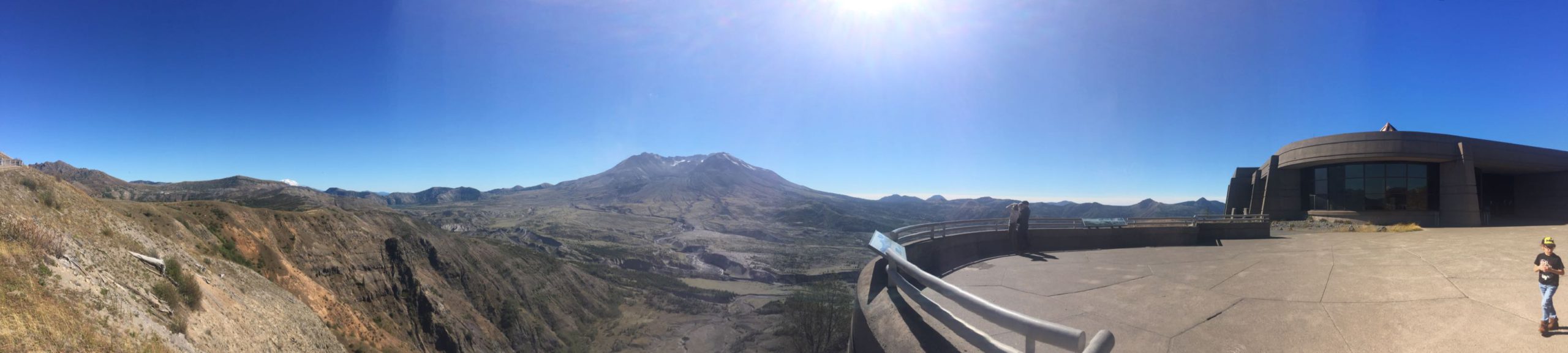
There were signs everywhere warning visitors to stay off the landscape. It’s clear that the park is investing in maintaining the effects of the scene created by the eruption all those decades earlier. But that also meant that there were numerous areas to turn off and enjoy the view. And what a view! The whole range, from Rainier to Saint Helens, unfolded before us with the sun beating down on us from a clear sky. We could not have asked for better weather. And the place was ours.
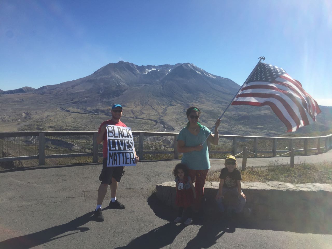
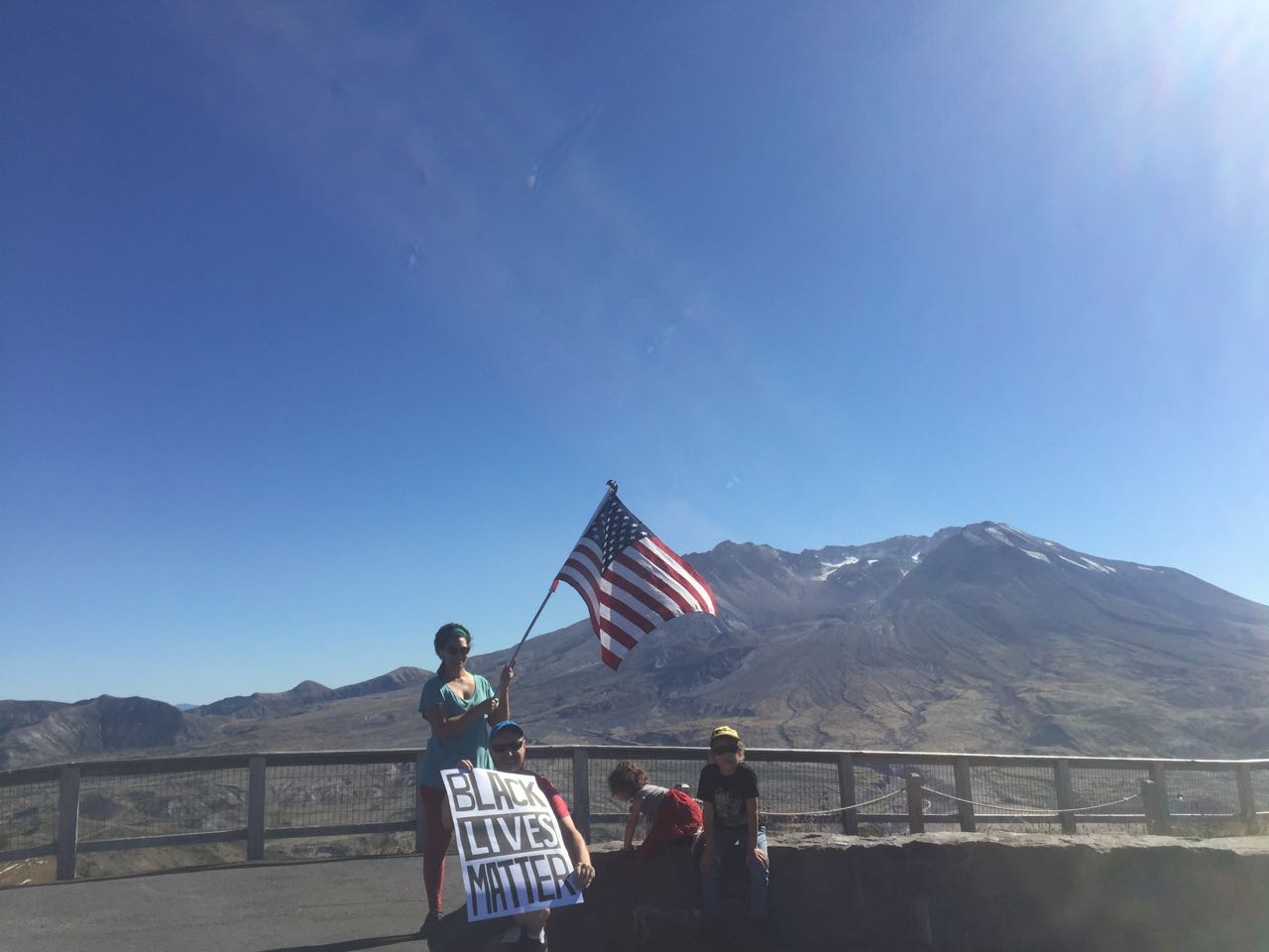
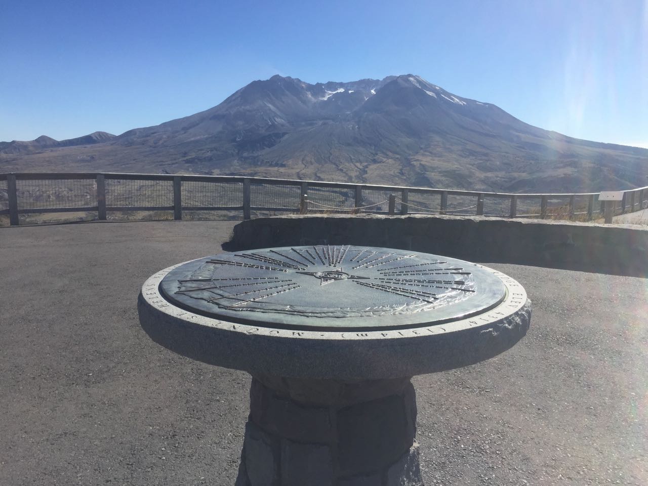
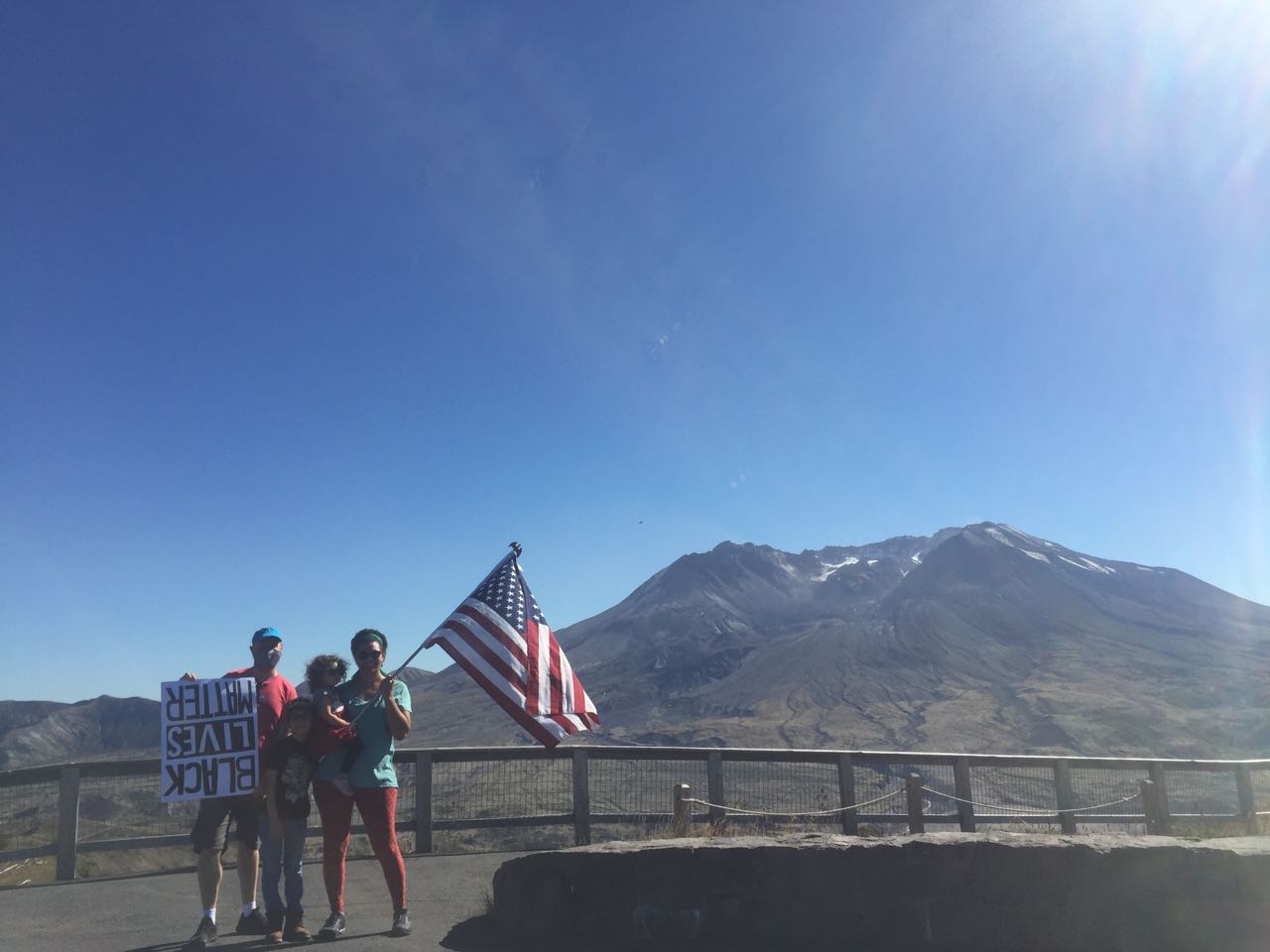
We arrived at a rotunda at the top of the trail. There was a plaque in the middle. At first I mistook it for a sundial, but it was a fixed compass indicating the directions to points-of-interest. There was plenty of space to set up. So we started the routine that was, by now, very familiar to us. I took a first shot to see what the lighting looked like, having to reframe because the sun was shining almost directly into my camera lens. I got back to the camera only to find out that I’d been holding our Black Lives Matter sign upside down. Yup.
“It’s like the mountain had a very powerful fart 40 years ago.“
We reset, and we reshot several times. Each time there was something wrong with the set. And none of them had good lighting. Things just weren’t panning out. The flag was covering the crater, or flapping in our faces as the wind whipped around. It couldn’t decide which direction it wanted to blow in, so the flag was either cooperating or not depending on the attempt. We tried as in other photos to have Aiden hold the flag open, but he was consistently in deep shadow. After about three attempts at 10 seconds each, Tori wasn’t having any of it… She wanted down.
It was so bizarre that all the other high pressure, time-sensitive shots that we’d taken worked out in precisely the way we needed them to. And now that we had our run of the place, we couldn’t make it work. I figure that ultimately speaks to the need to get the lighting right.

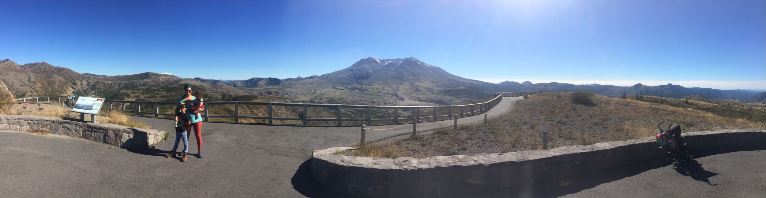
In another ironic turn, we heard a couple coming up the trail behind us. I desperately wanted to get a good shot so we could move on with our day and enjoy ourselves on the trail. We reset again and I thought I had all the things right that time, the angle of our sign relative to the sun, the kids out of our own shadows that we, the flag, or the sign were casting. All of it was great, but Tori decided that she wanted to climb up next to bubba (her name for Aiden). She was making progress and I hit the button, motivated by approaching voices. 10 seconds. And… she slipped as I walked over to get into position.
The couple on the trail saw this mini circus and offered to take the shot for us. We asked them if they were ok participating in what amounted to a political demonstration. They enthusiastically said that they agreed with our statement, and I handed my phone over; forgetting to turn off the 10 second delay. We got all set with perfect framing and then had to wait for the camera to count down. During that time, Tori wandered off. We have pictures of her facing various directions, including one with her butt in the air trying to situation herself next to her brother. But we got our shot. Third time was the charm!
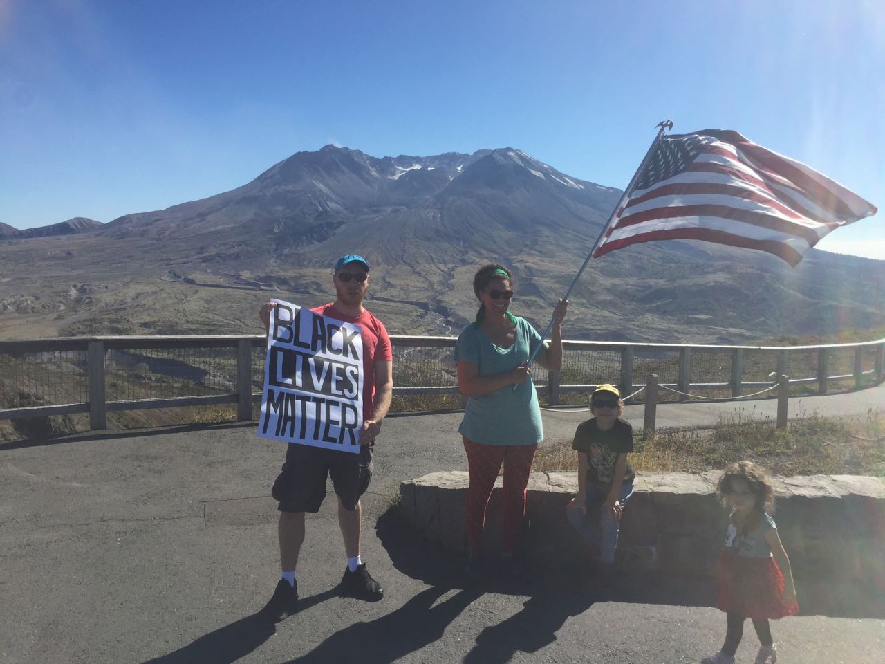
All of that effort, and we relied on the kindness of strangers to get it right. What irony! The place was empty before and after, not a soul around. We thanked the couple, and they continued their hike.
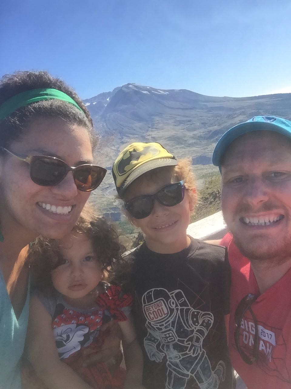
We broke down our setup and loaded the stroller back up, took some panoramas, and an attempted family selfie, and then we headed down the trail in the opposite direction of observatory. We realized that the trail didn’t go all the way back down to the parking lot, so we doubled back the way we’d come. That was just as well, however, because it gave us a chance to stop at the observatory gift shop and purchase some mementos of the visit. On the way back, Aiden stopped to read a sign detailing the explosion. He walked thoughtfully for a while and then said all at once “It’s like the mountain had a very powerful fart 40 years ago.”